Allamuchy Pond Fishing Spot
- Acreage: 50
- Elevation: 781'
- Last Modified By: vinny60 on 09/06/09 08:19 PM
- Ask about Allamuchy Pond in our Fishing Forums
Photos
Fish Species
Comments
-
Have you fished at Allamuchy Pond? Be the first to comment on this fishing spot.
Allamuchy Pond Baits and Tackle
Worm Check Prices
- Just bouncing a green rubber worm around the lilly pas and BAM!!
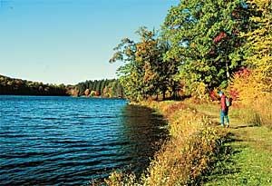
Allamuchy Pond Description
Allamuchy Mountain State Park is located 3 miles north of Hackettstown between Willow Grove/Waterloo Road (Route 604) on the east, Route 517 on the west and Cranberry Lake (Route 206) on the north. ALLAMUCHY NATURAL AREA - The Allamuchy Natural Area is a patchwork of different natural habitats with some 15 miles of trails criss-crossing over the land. From these trails, visitors have an excellent opportunity to view the beauty of mixed oak hardwood forests, hemlock-spruce forests, successional fields, lush swamp-hardwood forests, and northern marshlands. As well as being an ideal place for exploring nature, the natural area provides ample recreational activities. Hiking, horseback riding, jogging and cross-country skiing can be enjoyed on the areas trail system. Deer Park Pond and Allamuchy Pond are plentiful with bass and pickerel for visitor's angling pleasure.